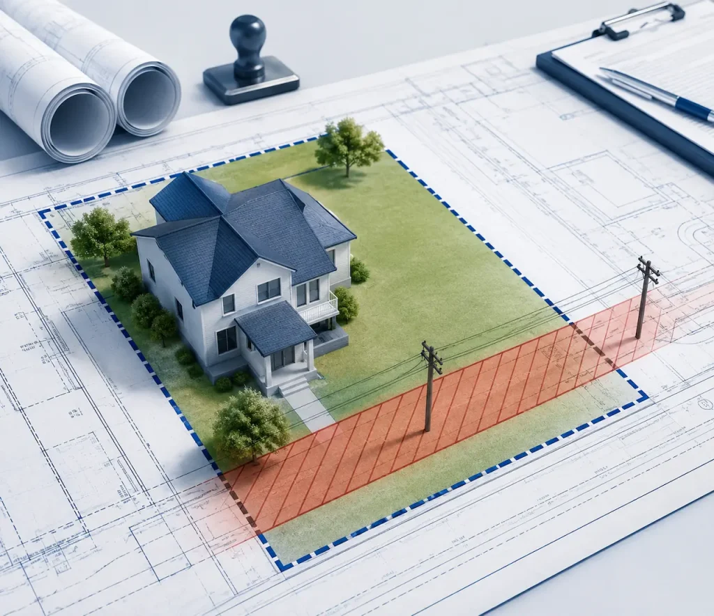

You want to build a fence, add a shed, or check whether your lot allows a second unit, and someone tells you to “just look it up on the GIS map.” You open your county’s map. Now you’re staring at a tangle of colored shapes, layer toggles with no explanation, and zoning codes like R-1A or C-2 that mean nothing to you yet.
We pull zoning and setback data off county GIS parcel maps every week while preparing permit-ready site plans, and almost every homeowner runs into the same wall: they can find the map, but they can’t find the two or three layers that actually answer their question. This guide walks through exactly where to click and what the data means.
A GIS Parcel Map is a free, publicly available online map — hosted by your county assessor or planning department — that shows your property’s boundaries, zoning district, and, in many counties, an overlay of setback or buildable-area lines. It pulls from the same records your building department uses to review permit applications, which makes it the fastest free starting point for any zoning or setback question, though it is not a substitute for a surveyed site plan when you actually submit for a permit.
What a GIS Parcel Map Actually Shows You
Every GIS parcel map is built from a handful of data layers stacked on top of a satellite or aerial base image. The three layers that matter for most homeowner projects are:
- Parcel boundaries – the surveyed property lines pulled from the county’s cadastral (land ownership) records
- Zoning district – a color-coded overlay showing what land-use category your parcel falls under (residential, commercial, agricultural, mixed-use, and so on)
- Setback or building envelope lines – in counties that publish this layer, a dashed line showing how far a structure must sit from the property line
Not every county publishes all three. Zoning is nearly universal on these maps; a dedicated setback layer is far less common, which is the single biggest source of confusion homeowners run into (more on that below).
Where to Find Your County’s GIS Parcel Map for Free
Start with a direct search for “[your county] GIS parcel viewer” or “[your county] assessor map.” Almost every county in the U.S. now runs one, usually through the Assessor’s Office, the Planning Department, or a shared GIS division. If the county-level search doesn’t return anything usable, try the state GIS clearinghouse — most states maintain one central portal that links out to every county’s individual map.
Once you’re on the map, search your address or parcel ID (found on your property tax bill) rather than scrolling to find your lot visually — most portals have a dedicated search box for this. From there, look for a “Layers” or “Legend” panel, usually a small icon in a corner of the screen, and turn on zoning and any setback-related layers one at a time so you can see what each one adds.
Setback rules themselves vary significantly by state, county, and even by zoning district within the same county, so once you’ve identified your zone on the map, it’s worth cross-checking the actual setback distance requirements for your state rather than assuming it matches a neighboring town.
How to Read the Zoning Layer
The zoning layer is almost always color-coded, with a legend somewhere on the screen (often a collapsible panel) explaining what each color and code means. Common codes you’ll run into:
- R-1, R-2, R-3 – single-family residential, with the number typically indicating density or minimum lot size
- RM – multi-family residential
- C-1, C-2 – neighborhood or general commercial
- A or AG – agricultural
- PUD – planned unit development, which often has its own custom rule set outside the standard zoning code
Clicking directly on your parcel (rather than just hovering) usually opens a pop-up with the exact zoning designation, and many county sites link that code straight to the relevant page of the zoning ordinance — which is where the actual allowed uses, height limits, and setback distances are written out in full.
If your project involves a fence, pool, or deck near a property line, it’s worth reading up on zoning laws for pools, fences, and decks before you finalize a design, since the rules are rarely as simple as a single blanket distance for every kind of structure.
Finding Setback Data When the Map Doesn’t Show It Directly
Here’s the part that trips up most people: a GIS parcel map identifying your zoning district is not the same as it showing your exact setback lines. Many counties stop at the zoning layer and expect you to look up the corresponding setback table in the written zoning ordinance yourself. Others go a step further and publish a “buildable area” or “setback” overlay directly on the map — usually as a dashed rectangle inset from the parcel boundary.
If your county’s map includes a measuring tool (often a ruler icon in the toolbar), you can use it to check the rough distance from an existing structure to the property line, which is useful for a sanity check before you start planning something new.
Just treat that on-screen measurement as an estimate — GIS parcel lines are drawn from assessor records for taxation purposes and are not always survey-accurate to the inch, which matters once you’re up against a minimum setback distance.
Common Mistakes People Make Reading Parcel Maps
A few issues come up constantly in forums and comment sections wherever homeowners discuss GIS parcel maps, and they’re worth flagging before you rely on what you see on screen:
- Assuming zoning and land use are the same thing. A parcel can be zoned commercial but currently used as a residence (a “legal nonconforming use”), or vice versa. The zoning layer tells you what’s allowed, not necessarily what’s already there.
- Treating the parcel line as the buildable line. The property boundary and the setback line are two different things — you can own the land, but you generally can’t build all the way to the edge of it.
- Not checking for easements. A utility, drainage, or access easement can cut straight across a legally buildable area shown on the parcel map, and most GIS viewers show easements as a thin, easy-to-miss line if they show them at all — which is exactly the kind of detail that can kill a project after a permit’s already in motion.
- Assuming the online map is legally sufficient for a permit submission. GIS data is a research tool, not a certified survey. Building departments require a scaled site plan or survey for the actual application, even if the GIS map gave you the right answer.
- Using outdated cached data. Zoning changes, rezonings, and boundary adjustments don’t always sync to the map instantly — cross-check anything unusual with the planning department directly.
That easement risk in particular is worth understanding in more detail — see what an easement is and how it can affect your project — before you assume a piece of land is fully buildable just because it’s inside your setback lines.
When a GIS Parcel Map Isn’t Enough
A GIS parcel map is the right free tool for early research: confirming your zoning, getting a rough sense of your setbacks, and deciding whether a project idea is even feasible before you spend money on it. It is not the document your building department will accept for an actual permit application. Once you’re past the research stage, you’ll need a to-scale, dimensioned drawing — and it helps to understand the difference between a site plan, a survey, and a plot plan, since building departments are specific about which one they’ll accept.
Conclusion
A GIS parcel map is the fastest, free way to confirm your property’s zoning district and get a rough read on your setback requirements before committing to a project. The key is knowing which layers to turn on, understanding that zoning and setback data aren’t always shown together, and treating the map as a research starting point rather than a permit-ready document. When you’re ready to move from research to an actual application, you’ll need a properly scaled site plan built from verified parcel data, zoning confirmation, and setback research — not a screenshot of the county map.
FAQs
1. Is a GIS parcel map the same as a property survey?
No. A GIS parcel map pulls boundary data from county assessor records for tax and planning purposes, while a survey is a legal, field-verified measurement of your property lines performed by a licensed surveyor. Building departments generally require survey-grade accuracy for permits, not GIS estimates.
2. Why does my county’s GIS map show zoning but not setback lines?
Many counties only maintain a zoning overlay and expect you to cross-reference the written zoning ordinance for the exact setback distance tied to your district. Publishing a dedicated setback layer requires more maintenance, so smaller counties often skip it.
3. Can I trust the acreage or lot size shown on a GIS parcel map?
It’s a reasonable estimate for planning purposes, but assessor records occasionally lag behind recent surveys, subdivisions, or boundary adjustments. For anything permit-related, confirm the figure against your deed or a current survey.
4. My property shows one zoning code, but my neighbor’s identical-looking lot shows another. What’s going on?
This usually means a rezoning line runs between the two parcels, or one property has a legal nonconforming use from before the current zoning code was adopted. It’s worth confirming directly with the planning department rather than assuming the map is wrong.
5. Does an easement shown on a GIS map affect where I can build?
Yes. An easement can restrict construction across part of your lot even if that area falls inside your setback lines and technically belongs to you. Always check the easement layer, if your county publishes one, before finalizing where a structure will sit.
Take the Next Step With Confidence
Avoid unnecessary delays and prepare for your permit application with greater confidence. Use our free tools to review your project and understand the next steps before moving forward.
ADU Feasibility Checker
Check whether your property may be suitable for an accessory dwelling unit.
Check ADU Feasibility 02Site Plan Checker
Review your drawing for common missing details and potential submission issues.
Review Your Site Plan 03Permit Requirements Checker
Identify the likely permit requirements for your location and project type.
Check Requirements 04Site Plan Cost Calculator
Get a quick site plan cost estimate based on your project requirements.
Calculate Your CostGet Your Permit Drawing Scope Reviewed
Send us the property address and project details. We’ll help identify the likely drawing scope and next step.

Engineer Wasim
Civil/Structural Engineer and founder behind Site Plans Online USA. His permit-drafting experience dates back to 2015, supporting residential, commercial, structural and site-development projects.
Learn More About Site Plans LLC →