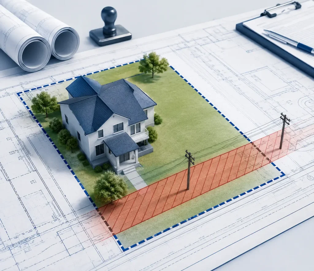
You’re applying for a building permit, and the city asks for a site plan. Your contractor says you need a property survey, while another professional calls it a plot plan. Are these three documents the same, or do you need to order them separately? A site plan, survey, and plot plan all describe property information, but they serve different purposes. A site plan shows how existing and proposed improvements fit on a property. A boundary survey establishes property boundaries through professional surveying. A plot plan usually provides a simpler overhead view of the lot, buildings, and setbacks.
The confusion matters because ordering the wrong document can delay a building permit, create unnecessary expenses, or leave important property information unverified. For a basic shed, fence, or patio permit, a drafting site plan may be sufficient if the local building department accepts it. For disputed boundaries, certain additions, or projects requiring certified measurements, a survey prepared by a licensed land surveyor may be necessary.
This guide explains the differences between these documents, what each includes, when they are required, and how to determine which one your building department will accept.
Site Plan vs Survey vs Plot Plan: Quick Comparison
The easiest way to understand the differences is to compare what each document establishes and how it is used.
| Feature | Site Plan | Boundary Survey | Plot Plan |
|---|---|---|---|
| Main Purpose | Show existing and proposed site improvements | Establish or retrace legal property boundaries | Show basic lot and building layout |
| Property Lines | Based on available verified or reference information | Determined through professional surveying | Often based on surveys, plats, or property records |
| Existing Structures | Yes | May show improvements, depending on scope | Usually |
| Proposed Construction | Commonly included | Not normally the primary purpose | May be included |
| Setback Dimensions | Commonly included | May support accurate setback measurements | Commonly included |
| Utilities and Drainage | When required | Depending on survey type and scope | Usually limited |
| Licensed Surveyor Required | Not always | Yes, for a professional boundary survey | Depends on local requirements |
| Typical Use | Building permits, zoning review, construction planning | Boundary verification, legal and property matters | Simple residential permits and property layouts |
The key difference is that a site plan explains how the property is or will be used, while a boundary survey establishes where the property boundaries are. A plot plan generally communicates a narrower set of property layout details, although some jurisdictions use the terms site plan and plot plan interchangeably.
What Is a Site Plan?
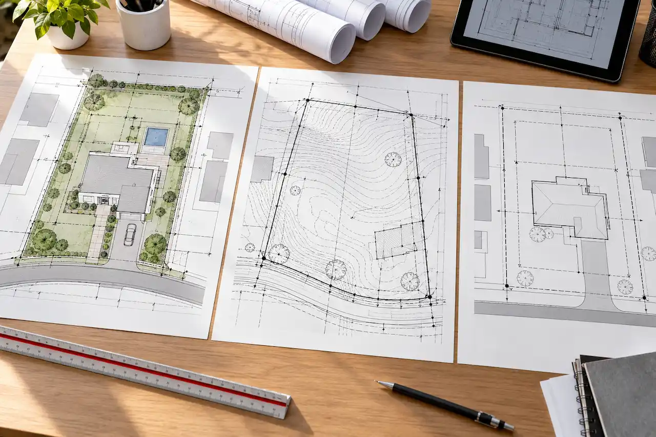
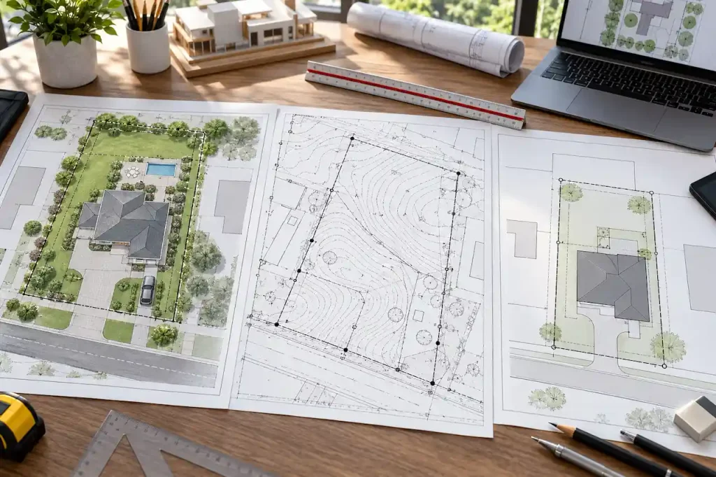
A site plan is a scaled overhead drawing showing a property’s layout, including existing structures, proposed construction, property lines, setbacks, access, and other relevant site features. It helps building and zoning officials understand where construction will take place and how the proposed work relates to surrounding property conditions.
For example, if you want to build a detached garage, the site plan may show the existing house, driveway, proposed garage footprint, property boundaries, and distances from the garage to each applicable property line.
The building department uses that information to evaluate zoning and site-related requirements. More complex projects may require additional details, such as parking layouts, drainage patterns, grading, utility connections, easements, landscaping, and fire access.
What Does a Site Plan Include?
A residential site plan commonly identifies the property address, lot dimensions, existing buildings, proposed improvements, and the distances between structures and property boundaries. It also typically includes a north arrow, drawing scale, labels, and relevant dimensions. For a pool permit, the drawing may show the pool location, surrounding structures, setbacks, equipment placement, and required access or safety-related site features.
For a commercial project, the site plan may include parking spaces, loading areas, accessible routes, vehicle circulation, and other development information. The level of detail depends on the project and local submission requirements.
Can a Site Plan Be Prepared Without a Survey?
Sometimes. A site plan may be prepared using existing surveys, recorded plats, parcel information, measurements, and other reliable property records when the local jurisdiction accepts that approach. However, a site plan prepared from public records is not a substitute for a licensed boundary survey.
If property boundaries are uncertain or the permit authority requires certified information, additional surveying may be necessary. The appropriate source documents should be identified before the drawing is prepared.
What Is a Property Survey?
A property survey is a professional measurement and documentation process used to establish or retrace property boundaries, identify relevant land features, or provide other surveyed information.
A boundary survey is performed by a licensed land surveyor operating under the applicable state’s professional requirements. Unlike a drafting site plan, a boundary survey involves evaluating legal descriptions, recorded documents, physical evidence, measurements, and other information needed to determine property boundaries.
The surveyor may locate existing monuments, identify boundary corners, and prepare a survey drawing showing the results.
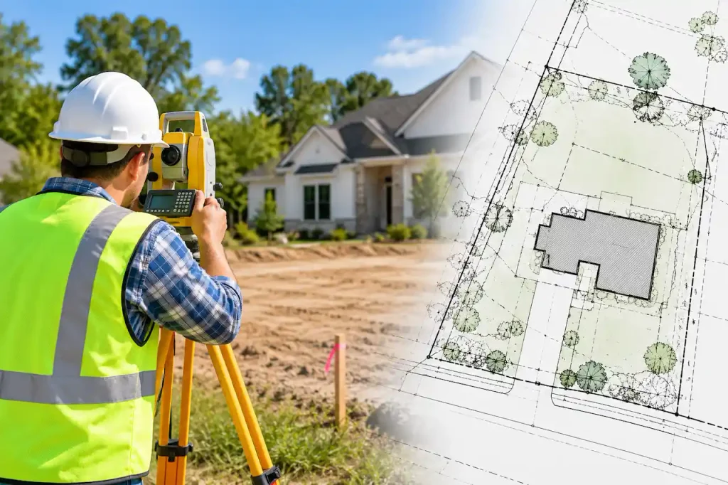
For example, a homeowner planning to build a fence directly along a property line may need a boundary survey to establish where that line actually lies. A county parcel map may provide a useful general reference, but it does not necessarily establish the precise legal boundary on the ground.
What Does a Boundary Survey Show?
A boundary survey typically documents the property boundaries and relevant measurements determined through the surveying process. Depending on the survey scope, it may also show improvements, encroachments, easements, monuments, and other property-related information. However, not every survey includes the same level of detail.
A boundary survey, topographic survey, ALTA/NSPS land title survey, and construction staking service address different needs. A basic boundary survey should not be assumed to include every elevation, utility, or improvement measurement needed for a complex permit application.
When Is a Licensed Survey Required?
A licensed survey may be required when a jurisdiction needs certified boundary information or when property conditions cannot be reliably established from existing documents. This can arise with additions close to setback limits, boundary disputes, construction near easements, subdivision work, or projects involving precise property-line verification.
Some building departments also require surveys for specific permit types regardless of whether the owner believes the existing records are accurate.
A licensed survey is especially important when the consequences of an incorrect boundary location could be significant.
What Is a Plot Plan?
A plot plan is an overhead drawing showing the arrangement of structures and improvements within a property. It commonly includes lot boundaries, existing buildings, proposed construction, and setback dimensions. For simple residential projects, a plot plan may provide enough information for zoning or permit review. For example, a homeowner adding a small shed might submit a plot plan showing the property dimensions, existing house, proposed shed, and required distances to lot lines.
A plot plan is often less detailed than a comprehensive site plan, particularly when grading, drainage, utilities, or complex development conditions are involved. However, terminology varies between jurisdictions.
Some municipalities call a basic residential site drawing a plot plan, while others use site plan for the same document. That is why the local building department’s checklist is more important than the document title alone.
Site Plan vs Plot Plan: Are They the Same?
In many residential permitting situations, the terms are used interchangeably. Both can show the property layout, existing structures, proposed improvements, and setback dimensions. The difference is often the level of detail expected. A basic plot plan may focus on the location of a proposed fence, shed, or garage. A more comprehensive site plan may address access, grading, utilities, drainage, parking, and development constraints.
For example, a detached shed permit may require only a simple overhead layout. A commercial building addition may require a detailed site plan coordinating parking, accessibility, stormwater management, and utility connections.
Neither document name automatically determines whether professional certification is required. If the permit checklist says plot plan, confirm what information must appear on it before ordering a drawing.
Site Plan vs Boundary Survey: Which One Is More Accurate?
A boundary survey is the appropriate professional service for determining legal property boundaries. A site plan is designed to communicate the arrangement of property improvements and proposed work. These documents answer different questions, so describing one as universally more accurate than the other can be misleading.
A professionally prepared site plan based on a current, reliable survey can show detailed building placement and setback information. However, a site plan based only on approximate public parcel mapping may not provide the boundary accuracy needed for construction near a property line.
For example, if a garage must be positioned close to a required setback, an inaccurate boundary reference could result in a noncompliant location.
A licensed boundary survey can provide the necessary boundary information, while the site plan can use that information to show the proposed garage. In this situation, the two documents complement each other.
Can You Use GIS or County Parcel Maps Instead of a Survey?
County GIS systems and parcel maps are useful tools for researching property information. They may show approximate parcel boundaries, lot dimensions, aerial imagery, nearby roads, and recorded parcel identifiers. However, public GIS mapping is generally intended for reference and planning rather than establishing precise legal boundaries.
Parcel lines displayed over satellite imagery may not align perfectly with fences, buildings, or other physical features. The apparent difference could result from imagery alignment, mapping methods, outdated records, or actual boundary conditions. A drafting professional may use GIS information as one source when preparing a site plan, provided the information is suitable for the project and accepted by the local jurisdiction.
But GIS data alone should not be treated as a certified boundary determination. For a deeper explanation, see the SitePlans.online guide on using GIS or county parcel records instead of a survey.
Which Document Do You Need for a Building Permit?
The correct document depends on the construction project, the property’s conditions, and the requirements of the reviewing jurisdiction. Some projects can proceed with a basic plot plan. Others need a detailed site plan, an existing boundary survey, or new professional surveying.
Common Permit Projects and Typical Documentation
| Project Type | Common Starting Document | When Additional Surveying May Be Needed |
|---|---|---|
| Fence | Plot plan or site plan | Boundary uncertainty or property-line placement |
| Shed | Residential site plan | Construction close to setbacks |
| Deck | Site plan and structural details | Uncertain boundaries or restrictive setbacks |
| Patio Cover | Site plan and relevant building drawings | Property-line or easement concerns |
| Swimming Pool | Site plan and pool-related permit documents | Precise setbacks or site constraints |
| Detached Garage | Site plan and building drawings | Close setbacks or unclear property dimensions |
| Home Addition | Site plan and architectural drawings | Boundary verification or jurisdiction requirement |
| ADU | Detailed site plan and permit drawing set | Complex setbacks, lot constraints, or survey requirement |
| Commercial Development | Detailed site and civil documentation | Often requires professional surveying and engineering |
This table is a general guide, not a nationwide permit rule. A municipality may require additional documentation even for a relatively small project.
Example: Building a Fence
Suppose you want to install a privacy fence around your backyard. The building department may ask for a plot plan showing the proposed fence location and property boundaries. If the fence is set well inside clearly established boundaries, the municipality may accept an existing property document or simple plan.
However, if you want to install the fence directly on the property line and the boundary is uncertain, a licensed survey may be necessary.
Example: Adding a Detached Garage
A detached garage usually involves more documentation than a simple fence. The site plan may need to show the proposed garage footprint, distances to property lines, driveway access, existing structures, and applicable zoning information. Separate architectural or structural drawings may also be required.
If the garage is close to a setback limit, reliable boundary information becomes particularly important.
Example: Constructing an ADU
An accessory dwelling unit can involve zoning, lot coverage, access, utility, building, and fire-safety considerations. The site plan may need to show the proposed unit, existing residence, parking where applicable, utility connections, setbacks, and relevant site conditions.
Depending on the jurisdiction and property, a current survey may be required. The site plan is only one part of the overall ADU permit drawing package.
How Much Does a Site Plan, Plot Plan, or Property Survey Cost?
The cost depends on who prepares the document, the complexity of the property, and the level of verification required. A basic residential site plan prepared from existing property records is generally less expensive than a new boundary survey involving fieldwork and legal record research.
A plot plan may cost about the same as a site plan when both refer to the same permit drawing.
| Document | Main Cost Factors | Relative Cost |
|---|---|---|
| Basic Site Plan | Parcel research, drafting, dimensions, permit requirements | Usually lower |
| Detailed Site Plan | Utilities, parking, drainage, grading, site complexity | Moderate to higher |
| Residential Plot Plan | Similar to a basic site plan | Usually lower |
| Boundary Survey | Field measurements, legal research, monuments, property complexity | Usually higher |
| Topographic Survey | Elevation measurements, terrain, site conditions | Higher for complex sites |
For current pricing, SitePlans.online advertises residential site plans starting at $79, with the final price depending on the drawing scope. A licensed survey quote should be obtained separately because costs vary substantially by location, property size, terrain, records, and survey requirements.
How Long Does It Take to Get Each Document?
A site plan prepared using available property information may be completed relatively quickly, especially for a straightforward residential project. The turnaround depends on whether reliable parcel records, measurements, and proposed project details are available.
A boundary survey usually requires additional coordination because the surveyor must evaluate property records and perform the necessary fieldwork. Properties with missing monuments, complicated legal descriptions, or boundary conflicts may require more time.
If you already have a current survey, a drafting professional may be able to use it to prepare a permit site plan without commissioning another survey, subject to the project’s requirements.
How to Determine Which Document Your Permit Office Requires
Before ordering a site plan or survey, check the permit application instructions published by your city or county. Pay particular attention to wording such as certified survey, boundary survey, plot plan, scaled site plan, or surveyor-prepared drawing.
Questions to Ask Your Building Department
- Does this project require a site plan, plot plan, or licensed boundary survey?
- Can the plan use an existing survey, recorded plat, or county parcel information?
- Are certified setback measurements or professional signatures required?
- What scale, dimensions, and supporting documents must be included?
- Will a previously prepared survey be accepted, or is updated fieldwork necessary?
These questions can help you avoid purchasing a document that does not satisfy the actual submission requirements.
Can You Prepare Your Own Site Plan or Plot Plan?
Some U.S. building departments allow homeowners to prepare site plans for straightforward residential projects. A homeowner may be able to draw the property outline, existing house, proposed structure, and relevant setbacks using reliable measurements and records. However, the drawing must meet the jurisdiction’s submission standards.
An unclear sketch, inaccurate boundary reference, or missing dimension may lead to a correction notice. A homeowner-prepared site plan also cannot replace professional surveying when the local authority requires a licensed surveyor. For larger or more complicated projects, professional drafting can help organize the required information into a coordinated drawing.
What Happens If You Submit a Site Plan When a Survey Is Required?
The building department may return the application for additional documentation or issue a correction notice. For example, a reviewer may request a survey because the proposed structure is close to a property line or the available boundary information is insufficient. In that situation, adding more notes to the site plan will not necessarily solve the problem.
The applicant may need to obtain a boundary survey and update the site plan using the verified information. This is why the permit checklist should be reviewed before ordering drawings.
Do You Need Both a Survey and a Site Plan?
Sometimes, yes. A boundary survey and a site plan serve complementary purposes. The survey establishes reliable boundary information, while the site plan uses relevant property information to show the proposed development. For example, a homeowner constructing an addition near a property boundary may need a licensed survey to verify the lot lines.
The site plan can then show the addition’s footprint, setbacks, existing structures, and other permit details using that information. Some jurisdictions may accept a survey with the proposed construction information added by an appropriately qualified professional. Others require a separate site plan.
The exact documentation should follow the building department’s instructions.
How to Order the Right Site Plan for Your Permit
The first step is identifying your project and the jurisdiction reviewing the permit. Gather the property address, available survey or plat, project description, and any drawings or sketches showing the proposed work. If the building department has already issued comments, provide the complete notice. A drafting professional can then review the information and help determine the appropriate site plan scope.
For residential projects where a non-certified site plan is accepted, SitePlans.online prepares property drawings using available parcel information, project details, and applicable permit requirements.
If a licensed survey is necessary, it should be obtained from a properly licensed land surveyor.
Get a Site Plan for Your Building Permit
Choosing between a site plan, plot plan, and survey does not need to be complicated. A site plan shows how existing and proposed improvements fit on your property. A plot plan often serves the same purpose for straightforward residential projects. A boundary survey establishes property lines through licensed professional surveying. The correct choice depends on what you are building and what your local permit office requires.
Site Plans Online USA helps homeowners, contractors, and property owners prepare residential and commercial site plans for permit applications nationwide.
Need a site plan for your next project? Visit SitePlans.online to request a quote and share your property details, project scope, and building department requirements.
Frequently Asked Questions
1. Is a site plan the same as a property survey?
No. A site plan shows the layout of a property and its existing or proposed improvements. A boundary survey establishes property boundaries through professional surveying. A site plan may use survey information, but it does not automatically replace a certified survey.
2. Is a plot plan the same as a site plan?
Often, yes. Many U.S. building departments use the terms interchangeably for residential permit drawings. However, some jurisdictions require additional details or use certified plot plan to describe a surveyor-prepared document.
3. Do I need a survey to get a building permit?
Not always. Some residential permits accept site plans prepared from reliable existing records. Other projects require licensed surveys, particularly when boundary accuracy, setbacks, or local regulations make professional verification necessary.
4. Can I use a county GIS map as my site plan?
A GIS map can provide useful reference information, but a raw parcel map may not include the dimensions, proposed construction, and permit details required by the building department. It also does not replace a licensed boundary survey.
5. Can a site plan show property lines?
Yes. Site plans commonly show property boundaries using available surveys, plats, or parcel records. However, depicting a property line on a drawing does not mean its legal position has been independently verified by a licensed surveyor.
6. Do I need a survey to build a fence?
It depends on the property and local requirements. A basic plot plan may be accepted for some fence permits. If the fence will be placed directly along an uncertain boundary, a licensed survey can help establish the correct property line.
7. Is a plot plan enough for a garage permit?
A plot plan or site plan may satisfy the site-layout portion of a detached garage permit. However, the building department may also require floor plans, elevations, foundation details, framing drawings, and engineering documentation.
8. Can I get a site plan without visiting the property?
Sometimes. A site plan may be prepared remotely using suitable records, measurements, photographs, and project information. However, field verification or surveying may be necessary when the available information is incomplete or the jurisdiction requires it.
9. Does a site plan need an engineer’s stamp?
Not always. Many straightforward residential site plans do not require professional engineering seals. Complex development, grading, drainage, structural, or other regulated work may require drawings prepared or sealed by licensed professionals.
10. Which is better for a building permit: a site plan or survey?
Neither is universally better because they serve different purposes. A site plan is generally used to communicate the proposed work and site layout. A survey is used to establish boundary information. Your building department may require one or both.
Get Your Permit Drawing Scope Reviewed
Send us the property address and project details. We’ll help identify the likely drawing scope and next step.

Engineer Wasim
Civil/Structural Engineer and founder behind Site Plans Online USA. His permit-drafting experience dates back to 2015, supporting residential, commercial, structural and site-development projects.
Learn More About Site Plans LLC →