

Table of Contents
- What Is a Site Plan — The Direct Answer
- What Is the Purpose of a Site Plan?
- What Is a Site Plan Drawing?
- What Is Included in a Site Plan?
- What Scale Is a Site Plan?
- What Is a Site Plan for a House?
- What Is a Building Site Plan?
- What Is a Site Plan in Architecture?
- What Is a Civil Site Plan?
- What Is a Site Layout Plan?
- All Other Types — Location, Development, Master
- Site Plan vs Survey vs Floor Plan
- What Is a Site Plan Review?
- How to Get a Site Plan
- Frequently Asked Questions
What Is a Site Plan — The Direct Answer
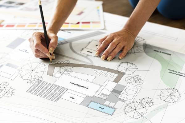
A site plan is a scaled, top-view drawing of a property that shows what exists on the land and what is proposed to be built on it. Every structure is shown in its correct position. Every measurement is drawn to a consistent scale. Every distance from proposed construction to property lines is explicitly labeled.
Think of it as a simplified aerial view of your property — not a photograph, but a technical drawing. The building department uses this drawing to answer one question: does this project comply with local zoning rules — specifically minimum setbacks from property lines and maximum lot coverage?
If you've been asked for a "site plan" by a building department, contractor, HOA, real estate attorney, or planning commission — this guide answers every question you'll have. I'm Engineer Wasim, founder of Site Plans Online USA. My team has prepared over 10,000 site plans across all 50 US states. Everything here comes from direct, daily experience with permit applications and plan review corrections.
Top-Down View
Always overhead. Shows lot, structures, and setbacks from above — never from the side.
Drawn to Scale
Every inch on paper represents a fixed number of feet on the ground. 1"=20' is most common.
Permit-Ready PDF
Black-and-white PDF submitted to your building department portal for review and approval.
What Is the Purpose of a Site Plan?
A site plan serves one core purpose: it gives decision-makers a clear, accurate picture of a property and what is proposed for it. Different parties use it for different reasons:
- Building departments use it to verify permit compliance. The plan reviewer checks setbacks, lot coverage, and existing conditions. Without a site plan, there is nothing to review and no permit gets issued.
- Planning commissions use it for discretionary review of commercial projects, conditional use permits, variances, and subdivisions. The commission evaluates compatibility with surrounding uses and local planning policies.
- Contractors and builders use it as the base document for construction coordination — where things sit, how utilities connect, how the project fits the lot.
- HOAs use it to confirm proposed improvements comply with community covenants before granting architectural approval.
- Real estate professionals use it to document existing conditions and communicate development potential to buyers and investors.
The purpose is always the same in practice: show what exists, show what's proposed, and confirm it meets the rules.
What Is a Site Plan Drawing?
A site plan drawing is the actual technical document — the scaled 2D drawing prepared using CAD software or drafted manually. Every site plan drawing has these characteristics:
- Drawn to consistent scale. If your lot is 100 feet wide and the scale is 1 inch = 20 feet, the lot measures exactly 5 inches wide on paper. This consistency is what makes the drawing useful for verification.
- Top-down view only. A site plan always looks straight down at the property from above. It does not show height — elevation drawings handle that. A site plan shows horizontal layout only.
- All elements labeled. Every structure, boundary, and dimension is labeled. An unlabeled drawing is not permit-ready and will be rejected.
- Black and white PDF. Most US building departments require black-and-white PDF submissions. Color appears in landscape plans and presentations, but permit site plans are monochrome.
- Title block in a corner. Every permit site plan includes an information box listing property address, parcel number, owner name, preparer, date, and scale.

A Site Plan Is Not a Photograph
Reviewers cannot use satellite imagery or Google Maps as a site plan. Those show approximate positions without verified dimensions. A proper technical drawing with labeled measurements is required every time.
What Is Included in a Site Plan?
The elements depend on project type and jurisdiction. Here is what most US building permit site plans must include — missing even one element causes a correction notice and delays your permit.
Property Identification
- Lot lines with dimensions — every property line measured and labeled in feet. Irregular lots require all angles documented.
- Legal description — the official description from the deed or county records. Must match county assessor records exactly. A minor discrepancy causes an administrative hold.
- Parcel ID number — called APN in California/Arizona, Folio number in Florida, Schedule number in Colorado, Tax parcel number in Pennsylvania and New York.
- Full property address — street number, name, city, zip as it appears in county records.
- Adjacent street names — all streets bordering the property labeled by name.
Property Boundaries
All lot lines measured in feet with dimensions labeled
North Arrow + Scale
Written scale AND graphic scale bar — both required by every US jurisdiction
Proposed Project
Labeled "PROPOSED," dimensioned, with all four setbacks shown
Impervious Surface
Required for pools, decks, driveways, and most additions
Drawing Standards
"Not to Scale" is never acceptable. Plans labeled NTS are automatically rejected by every US building department without exception. Both a written scale (e.g., 1"=20') and a graphic scale bar must appear on the plan.
Existing Conditions — What Most Plans Miss
Every existing structure on the lot must appear on your site plan. This is where most DIY and online-template plans fail. Reviewers cross-reference your plan against county GIS data and satellite imagery. Anything visible from above that is not on your plan gets flagged as a correction.
- Main house with footprint dimensions
- Attached and detached garage
- Swimming pool or spa
- Sheds and storage buildings
- Carports and covered structures
- Concrete patios and wood decks
- Full driveway outline
- Fence lines
- A/C equipment pads
- All recorded easements (drainage, utility, access)
Setback Dimensions — The Most Critical Element
A setback is the minimum required distance between a structure and a property line. Every permit site plan must show all four: front, rear, left side, and right side. Missing even one triggers a correction notice and delays your permit.
Setbacks are shown as dimension arrows with the distance in feet labeled at the midpoint. The proposed structure must clear every minimum setback requirement set by your local zoning code — which varies significantly by county, city, and zoning district.
Required Calculations
Impervious surface calculation is required for most projects adding hard surface. It shows total hard surface coverage as a percentage of lot area compared to the zoning maximum:
Total: 3,450 sq ft | Coverage: 38.3% | Zone Maximum: 55% ✓
What Scale Is a Site Plan?
Scale is the most important technical element of a site plan. Without consistent, verifiable scale, no dimension can be confirmed and the plan cannot be used for permit review.
| Scale | Real Feet Per Inch | Best For |
|---|---|---|
| 1" = 10' | 10 ft | Small lots, detailed addition areas |
| 1" = 20' | 20 ft | Standard residential — most common Recommended |
| 1" = 30' | 30 ft | Larger residential lots |
| 1" = 40' | 40 ft | Acreage, rural properties |
| 1" = 50' | 50 ft | Commercial sites, large developments |
How scale works: At 1"=20', a 40-foot house draws exactly 2 inches on paper. A 100-foot lot line draws exactly 5 inches. Every measurement maintains this consistent ratio across the entire drawing. Both written and graphic scale are required. Written scale tells you the ratio. The graphic scale bar lets you verify any dimension physically — even if the PDF was printed at a different size.
What Is a Site Plan for a House?
A site plan for a house is a residential site plan. The most common reasons homeowners need one:
- Building permit — any exterior improvement that requires a permit: pool, fence, shed, deck, addition, garage, ADU, driveway. The building department uses the site plan to confirm setbacks and lot coverage.
- New home construction — part of the full permit set showing house placement, setbacks, driveway location, and utility connections.
- HOA approval — many communities require a site plan before approving exterior improvements such as sheds, pergolas, pools, or fence modifications.
For most residential permits, a non-certified site plan prepared by a professional drafter is sufficient. A licensed architect or surveyor stamp is not required for pool, fence, shed, or deck permits in most US states.
What Is a Building Site Plan?
A building site plan is the site plan submitted with a building permit application. It distinguishes the permit-submission document from an architectural site plan (design tool) or civil site plan (engineering document).
A building site plan focuses on: lot boundaries, setbacks, existing structures, proposed construction, and compliance calculations. This is what the plan reviewer evaluates. It is functional and minimal — not an architectural presentation.
What Is a Site Plan in Architecture?
In architecture, a site plan is a drawing showing a building in context on its site. It is part of a complete architectural drawing set and shows: building orientation on the lot, pedestrian and vehicular access, landscape placement, shadow and view relationships, and how the project relates to surrounding streets and buildings.
An architectural site plan often goes beyond a permit site plan — it may include architectural massing, landscape design, and contextual rendering. For basic residential permits, the simpler permit site plan is what building departments need. For commercial development, planning commission review, and design review boards, the architectural site plan becomes the primary submission document.
What Is a Civil Site Plan?
A civil site plan is prepared by a licensed civil engineer and covers the engineering aspects of site development — grading, drainage, utilities, road access, and stormwater management. Professional engineer sealing requirements vary by jurisdiction and project scope.
Required for:
- New commercial construction
- Residential subdivisions
- Any project requiring a grading permit
- Projects in FEMA flood zones
- Projects requiring Water Management District or Army Corps review
A civil site plan goes well beyond a basic permit site plan: drainage flow calculations, cut and fill volumes, stormwater detention sizing, utility connection details, and finished grade elevations across the entire site. Not relevant to homeowners pulling standard residential permits.
What Is a Site Layout Plan?
In construction, a site layout plan (or construction site logistics plan) is an operational drawing showing how the physical construction site will be organized during the build — not how the finished property will look.
A construction site layout plan shows: temporary site office and storage container locations, material staging and laydown areas, equipment access roads and turning radii, crane position and swing zone, temporary safety fencing, portable restroom locations, and emergency vehicle access. This is a project management document, not a permit document.
In some UK and Australian planning systems, "site layout plan" means what US building departments call a "site plan." If you encounter this term in a US permit application, treat it as a standard residential site plan.
All Other Types of Site Plans
Beyond the standard permit site plan, several specialized plan types exist for specific situations:
Site Location Plan Context Map
Shows the property within its broader area — streets, neighborhoods, and landmarks. In the US, a Google Maps screenshot with the site marked typically satisfies a "vicinity map" requirement.
Site Development Plan Engineering
Full engineering package for larger projects — grading, stormwater, utilities, road access. Prepared by a civil engineer. Not relevant to standard residential permits.
Preliminary Site Plan Pre-Permit
Early-stage drawing showing general layout before final accuracy. Used for pre-application meetings, feasibility review, and investor presentations. Not dimensioned for permit submission.
Conceptual Site Plan Early Stage
Shows development intent without final accuracy. Used for planning department pre-applications and HOA early review. Not a permit submission document.
Master Site Plan Long-Term Vision
Full long-term development vision for a large property or campus, often phased over multiple years. Used for universities, mixed-use developments, planned communities.
Subdivision Site Plan New Lots
Drawing package for dividing one parcel into multiple new lots. Requires licensed land surveyor for boundary elements. Goes through planning commission review.
Photometric Site Plan Lighting
Shows distribution of artificial light across a site from exterior fixtures. Required for commercial parking lots and projects near residential zones.
Landscaping Site Plan Planting
Shows landscaping layout — plants, trees, irrigation, paving. Required for commercial projects and some residential permits in California cities. Learn more →
Site Plan vs Survey vs Floor Plan vs Plot Plan
| Drawing Type | What It Shows | View | License Required? |
|---|---|---|---|
| Site plan | Property layout, lot lines, structures, setbacks | Top-down | No (residential) |
| Floor plan | Interior rooms, walls, doors, windows | Top-down (inside) | Varies |
| Elevation drawing | Exterior faces of building | Side view | No |
| Survey | Legal boundary certification | Top-down | Yes — Licensed Surveyor |
| Civil / grading plan | Drainage, grading, utilities | Top-down + elevation | Yes — Licensed PE |
| Section drawing | Cross-section through structure | Side, cut view | No |
Site plan vs floor plan: A site plan shows the property from outside and above — where the building sits on the lot. A floor plan shows the inside of the building — room layout, walls, and doors. They are completely different drawings showing completely different information.
Site plan vs plot plan: In most US jurisdictions, they are the same document. Different building departments use different terms. Both refer to the scaled overhead property drawing required for permit submission.
Site plan vs survey: A survey certifies boundaries as a legal document and requires a licensed surveyor. A site plan uses boundary data to show project placement — no surveyor license required for most residential work. For most US residential permits, a licensed survey is not required. We prepare site plans from GIS data and county parcel records — accepted by many US building departments when local requirements allow. Read: Site Plan vs Survey vs Plot Plan — Full Explanation →
What Is a Site Plan Review?
Site plan review is the formal evaluation process by which a government agency evaluates a submitted site plan against applicable standards. Two types exist:
- Administrative (ministerial) review: Checklist-based. If the plan meets all objective standards — correct setbacks, adequate lot coverage, all required elements present — the permit is approved. No discretionary judgment. Most residential permits use this process. Timelines: 1–2 weeks in fast jurisdictions, 4–8 weeks in LA or San Diego.
- Discretionary review (planning commission): Evaluated against design standards, compatibility, and planning policies. Public hearing required. Used for commercial development, conditional use permits, variances, and subdivisions. Timelines: 3–6 months.
Site plan approval for building permits happens as part of the permit issuance — the permit itself is the approval. For commercial development, site plan approval can be a distinct standalone step from the planning commission before building permits are applied for.
How to Get a Site Plan
There are four ways to get a site plan in the US:
- 1
Online Service — Fastest for Permits
Prepared remotely using GIS data and county records. No site visit required. Permit-ready PDF in 12–24 hours for most residential projects. Starting from $79. Free revisions included. How to get a site plan of your property →
- 2
Local Drafter or Architect
In-person service, typically 1–3 weeks turnaround, higher cost. Necessary when a licensed professional stamp is specifically required by your jurisdiction — for example, some commercial projects or ADUs in certain cities.
- 3
County Permit Records
Previous permits may have site plans on file. Search your county building department portal by address or parcel number. Free, but previous plans may be outdated or not show your proposed project.
- 4
DIY
Possible for very simple projects. High rejection rate for inexperienced drafters — missing setback dimensions, incorrect scale, or missing structures are the most common DIY errors. DIY vs professional comparison →