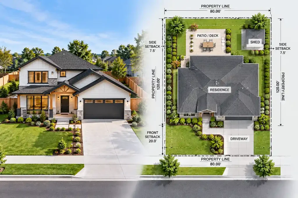
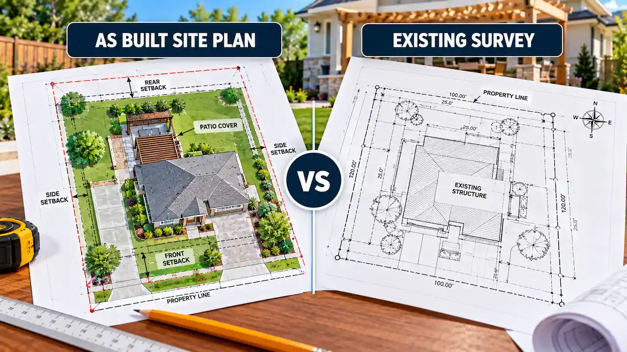
You already have a property survey in your records, but the city is asking for a site plan showing existing conditions. Can you submit the old survey, or do you need a new as built site plan? This depends on what the permit office is trying to verify. An existing survey can provide valuable information about property boundaries and the improvements that existed when the survey was completed. An as built site plan documents the property’s current improvements and layout for planning, permitting, recordkeeping, or other project needs.
They can contain similar information, but they are not automatically interchangeable.
If the city specifically requires a current boundary survey or an as built survey prepared by a licensed surveyor, a drafted as built site plan cannot replace it. If the reviewer primarily needs an updated drawing of existing structures and site conditions, an as built site plan may be appropriate when the jurisdiction accepts that type of document.
The key is determining what needs to be verified, how current the information must be, and whether professional surveying is specifically required.
What Is an As Built Site Plan?
An as built site plan represents the improvements and site conditions that exist on a property after construction or development has occurred. Rather than showing only what was originally proposed, it aims to document what is actually present. Depending on its purpose and source information, an as built site plan may show the house or primary building, garages, additions, sheds, pools, decks, driveways, patios, walkways, fences, and other relevant improvements.
It may also identify property boundaries from available records, dimensions, setbacks, easements, or other information needed for the particular use. The important point is that “as built” describes the existing condition being documented. It does not automatically mean the document is a professional boundary survey.
What Is an Existing Property Survey?
An existing survey is a survey that was previously prepared for the property. You may have received one when purchasing the home, refinancing, building an addition, completing another permit, or having the property professionally surveyed. Depending on its type and scope, the survey may show property boundaries, dimensions, monuments, easements, buildings, fences, encroachments, or other features.
For a new permit application, the most important questions are:
Is the survey still representative of the property?
Does it contain the information the city currently requires?
A survey can remain valuable even when it is several years old, but later construction may make the site conditions shown on it incomplete.
The Main Difference: Current Improvements vs. Boundary Verification
The easiest way to understand the difference is to ask what problem each document is solving. An as built site plan is generally focused on documenting the current physical layout of the site. A professional property survey is focused on surveying information within the scope of the survey, which may include establishing or documenting boundaries and locating improvements relative to those boundaries. There can be overlap.
For example, both documents may show a house, garage, driveway, and property lines. But similar-looking drawings do not necessarily have the same professional status, accuracy, certification, or legal purpose.
That distinction matters when a permit office uses terms such as “survey,” “certified survey,” or “as built survey.”
As Built Site Plan vs. As Built Survey
These two terms are particularly easy to confuse.
An as built site plan can be a drafted representation of current property improvements based on appropriate available information.
An as built survey generally involves surveying work performed by a licensed land surveyor to document current improvements and their relationship to surveyed boundaries or other features within the survey’s scope.
If the permit authority specifically asks for an as built survey, do not assume an ordinary drafted site plan will satisfy the request. Likewise, if the city simply needs an updated site drawing showing existing conditions and accepts a non-certified plan, commissioning a new professional survey may not always be necessary. The exact wording of the requirement matters.
When an Existing Survey May Be Enough
An existing survey can sometimes provide exactly what is needed. Suppose your survey accurately shows the house, garage, driveway, property boundaries, and other relevant improvements, and nothing affecting the current application has changed since it was prepared.
If the permit authority accepts that existing survey for the current application, there may be no reason to recreate the same information.But acceptance should not be assumed.
Some jurisdictions or permit types require more current information. Others may require the proposed work to be added to the survey or incorporated into a separate site plan. The project’s scope also matters.
A document that was sufficient for a fence application may not contain everything needed for an addition, garage, pool, ADU, or more complex development.
When an Old Survey Is No Longer Enough
Imagine your survey was prepared before you installed a detached garage, expanded the driveway, added a pool, built a shed, and enclosed part of the patio.
The property shown on the survey no longer matches the property as it exists today.
That does not necessarily make the survey worthless.
It can still be an important source of boundary and historical information.
But submitting it by itself may leave the permit reviewer with an incomplete picture of current conditions.
An updated site plan may need to incorporate the newer improvements.
If the jurisdiction requires those improvements to be professionally surveyed, then an updated survey—not merely a drafted plan—may be required.
When Does the City Usually Care About Existing Conditions?
Existing conditions become especially important when they affect the new permit or explain previous construction. For example, you may be applying for:
- A new addition near an existing garage
- A pool where several accessory structures already exist
- An ADU on a developed lot
- A garage conversion
- A retroactive permit for previously completed work
- A new project affected by existing lot coverage
- A permit correction requesting a clearer property layout
In these situations, the reviewer needs to understand what is already present before evaluating what is proposed. An incomplete existing-condition drawing can affect setback, coverage, access, drainage, and other reviews.
As Built Plans for Work That Was Already Constructed
One important use case is construction that already exists but is not adequately reflected in the available drawings. Perhaps a previous owner built an addition, converted a garage, added a patio cover, or installed another improvement. Now the city is requesting documentation as part of a permit, code-compliance matter, property update, or new project. An as built drawing can help document the existing configuration.
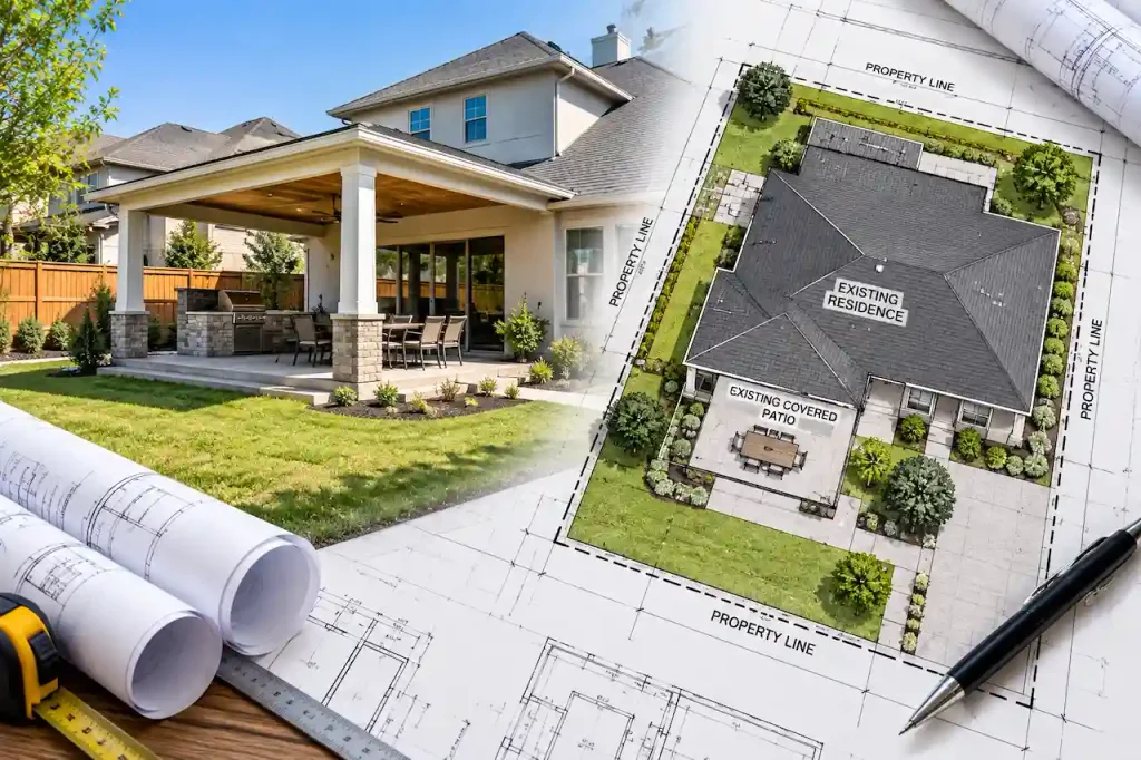
However, creating a drawing of an existing improvement does not automatically legalize or approve the work. The city may still require permit review, construction details, structural evaluation, engineering, inspections, corrections, or other documentation. The as built plan documents conditions. The permitting authority determines what is required to approve or resolve them.
Retroactive Permits May Need More Than an As Built Site Plan
If work was completed without the required permit, the city may ask for drawings representing the existing construction. A site plan may be one part of that package.
For example, the site plan can show where the unpermitted garage or addition is located relative to property boundaries and other structures.
But the city may also need floor plans, elevations, sections, structural details, engineering, photographs, inspections, or other documentation. This is an important distinction.
An as built site plan answers the site location question. It does not necessarily answer every building-code or structural question about previously completed work.
Existing Survey + New Site Plan Can Sometimes Work Together
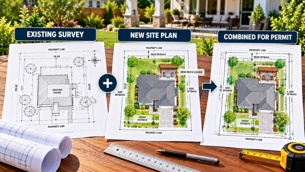
An older survey and a new site plan do not always have to compete with each other. In many projects, the existing survey is useful source material. The survey may provide reliable information about property boundaries and conditions that existed when it was completed. An updated site plan can then communicate newer improvements or proposed work, where the jurisdiction permits that approach.
For example, suppose the survey shows the property boundaries and house accurately, but a newer shed and driveway extension are missing.
Those documents can be reviewed together when determining what needs to appear on the updated permit drawing. The existing survey can therefore remain valuable even if it is not sufficient as the final submission by itself.
Can GIS Be Used to Update an Old Survey?
GIS and aerial imagery may help identify changes or provide general property context, but they should not be treated as a replacement for professional surveying. Aerial imagery might show that a new shed, pool, driveway, or addition exists.
County parcel data might provide useful property-record information. But neither source automatically establishes surveyed boundaries or professionally surveyed improvement locations.
If a non-certified existing-condition site plan is acceptable, GIS may be one source of supporting information. If the city requires a survey, GIS does not convert an old survey into a current professional survey.
What If the City Says “Current Site Plan”?
This wording requires closer attention. “Current site plan” may simply mean the city wants a drawing that reflects the property as it exists now and includes the proposed project But the exact requirement can vary.
Check whether the city’s instructions also use terms such as:
Boundary survey
Certified survey
As built survey
Signed and sealed survey
Site plan prepared by…
Those phrases may indicate a professional requirement beyond ordinary drafting. If the checklist does not clearly define “current site plan,” confirm whether the city will accept an updated non-certified site plan based on available records.
What If the City Says “As Built Survey”?
Treat that as different from a generic request for an as built drawing. A request specifically using the word survey can indicate that the city expects professional surveying work. Do not simply rename a drafted site plan “as built survey.” If the requirement is unclear, ask the reviewer whether the document must be prepared or certified by a licensed land surveyor.
This is especially important for final approvals, boundary-sensitive construction, certificates, subdivision matters, and other situations where verified locations may be important.
Does an As Built Site Plan Show Property Lines?
It can show property boundaries based on the source information used to prepare the drawing. But showing a boundary line on a plan does not mean the drafter independently established that boundary through surveying.
For example, boundaries might be derived from an existing survey or recorded plat That source should not be misrepresented.
When legally or technically verified boundary locations are required, appropriate professional surveying should be obtained. This distinction protects both the property owner and the integrity of the permit submission.
What About Setbacks?
Setbacks make reliable property information particularly important. A permit reviewer may need to determine how far an existing or proposed structure is from a property boundary. If the building is comfortably inside the lot and the jurisdiction accepts available records, a non-certified drawing may be appropriate for some applications.
If an existing structure sits close to a required setback or potentially crosses it, the accuracy of the boundary becomes much more important. Do not use an approximate GIS boundary to make a precise claim about a potentially noncompliant structure. The project may require a survey or additional zoning review.
Lot Coverage Is Another Reason Current Conditions Matter
Suppose an old survey shows only the original house and driveway. Since then, the property has gained a garage, covered patio, shed, and other improvements. If the city needs to calculate current building or lot coverage, relying solely on the old drawing could produce an incomplete calculation.
The current-condition plan should account for the improvements relevant to the jurisdiction’s coverage definition. This becomes particularly important before proposing another addition. A new structure can satisfy individual setback requirements while still creating a lot-coverage issue.
Existing Conditions vs. Proposed Conditions
A useful permit drawing should make this distinction obvious.
Existing conditions show what is on the property now.
Proposed conditions show what will change if the permit is approved and the project is completed.
For example, if you plan to build a garage, the site plan may show the current house, driveway, shed, and other improvements as existing while clearly identifying the garage as proposed.
If an existing shed will be demolished, that should also be communicated where relevant. Clear labeling helps the reviewer understand the project’s actual scope.
Do You Need an As Built Site Plan for a New Addition?
An addition changes the building footprint, so the permit office generally needs to understand both the existing house and the proposed expansion. If existing records accurately represent the property, they may provide a good starting point.
If the property has changed significantly since those records were created, updated existing-condition information may be necessary. The site plan can then show the proposed addition relative to property boundaries, setbacks, other structures, easements, and applicable site constraints.
Whether professional surveying is required depends on the jurisdiction and project.
Do You Need a New Survey Every Time the Property Changes?
A new fence, patio, shed, driveway, or other change does not by itself mean every future permit will require a brand-new boundary survey. The relevant question is whether the current project requires professional surveying and whether the existing information is adequate.
Some permit authorities accept existing surveys supplemented by updated permit drawings. Others require current surveyed information for particular projects. Rather than ordering a new survey automatically, check the permit requirements first.
But if the jurisdiction requires one, or reliable boundary information cannot otherwise be established, obtain the appropriate survey.
How to Decide Which Document You Need
Start with the exact wording from the permit office.
If it says existing survey, determine whether the survey you already have meets the stated requirements.
If it says site plan, check what information must appear on the plan and whether professional certification is required.
If it says as built site plan, determine whether the city needs an updated drawing of current improvements.
If it says boundary survey or as built survey, confirm the professional surveying requirements rather than assuming an ordinary drafted plan will work.
Then compare those requirements with the documents you already have. The document’s purpose matters more than simply choosing the least expensive or quickest option.
What Should You Provide Before an As Built Plan Is Prepared?
Gather as much existing property documentation as possible. An older survey is especially valuable because it may provide reliable boundary information and dimensions from the time it was prepared. Recorded plats, previous permit plans, county records, and other property documents can also help.
Identify improvements that have been added, removed, or changed since the existing documents were created. If the city has issued a permit checklist or correction notice, provide it as well. That information helps determine what needs to be documented and whether drafting alone is appropriate.
Common Mistakes When Reusing an Existing Survey
The biggest mistake is assuming that because a survey was professionally prepared, it automatically represents today’s property. Always compare the drawing with current conditions. Look for structures or improvements that have been added or removed. Another mistake is modifying a survey casually and presenting the altered document as though the surveyor certified the new information. Do not misrepresent changes as part of the original surveyor’s work. If an updated drawing is prepared from an existing survey, it should be clear what the new document represents and what source information was used.
As Built Site Plan vs Existing Survey: A Practical Example
Imagine a homeowner has a survey from when the house was purchased.
At that time, the property contained the house and original driveway.
Over the next several years, a detached shed, covered patio, and driveway extension were added.
The homeowner now wants a new garage.
The old survey remains useful because it provides important historical and property information.
But it does not show all current improvements.
The permit reviewer may need those improvements to evaluate garage placement, setbacks, access, and lot coverage.
If the jurisdiction accepts a non-certified updated site plan, the existing survey and other appropriate records may provide source information for preparing it.
If the city requires a new or updated professional survey, then that requirement controls.
This is why there is no universal answer based only on the age of the survey.
Which Does the City Need?
The city needs the document that satisfies the requirements of the specific application.
An existing survey may be sufficient when it is accepted by the jurisdiction, still represents the relevant property conditions, and contains the information needed for review.
An as built site plan may be appropriate when the city needs a current representation of existing improvements and accepts a drafted plan based on suitable property information.
A new or updated survey may be required when the city specifically asks for professional surveying, current surveyed conditions, or reliable boundary information that the existing records cannot provide.
Do not choose solely based on the document name. Determine what the reviewer needs to verify.
Need an Updated As Built Site Plan?
Site Plans Online prepares as built site plans and other permit drawings for projects where a drafted existing-condition plan is appropriate. If you already have a property survey, keep it. Provide the survey along with the property address, information about improvements added or changed since it was prepared, and any permit checklist or correction notice from the city.
Those documents can help determine whether an updated site plan can address the project or whether additional professional surveying or other services are required.
The objective is to prepare the right document for the permit review—not to replace a professional survey where one is required.
Frequently Asked Questions
Is an as built site plan the same as a survey?
No. An as built site plan can document existing improvements, but it does not automatically constitute professional surveying. If the city requires a licensed surveyor’s work, a standard drafted site plan is not a substitute.
Can I use an old survey for a new permit?
Possibly. An existing survey can remain useful if the jurisdiction accepts it and the relevant property conditions have not changed. New improvements may need to be documented separately or through an updated plan.
When is an existing survey too old?
There is no universal age at which every survey becomes unusable. Acceptance depends on the jurisdiction, project, current property conditions, and whether the document contains the information required for review.
What is the difference between an as built site plan and an as built survey?
An as built site plan documents existing site conditions through drafting based on appropriate source information. An as built survey involves professional surveying services. If a jurisdiction specifically requests an as built survey, confirm its licensed-surveyor requirements.
Can I update an old survey myself?
You can provide information about property changes, but you should not alter a professional survey in a way that implies the original surveyor verified new information. An updated permit drawing should clearly represent its own scope and sources.
Do I need a new survey after adding a shed or patio?
Not automatically. Whether a new survey is required depends on the next project’s requirements and the jurisdiction. Existing documents may sometimes support an updated non-certified site plan.
Can an as built site plan be used for an unpermitted structure?
It may help document the structure’s existing location, but it does not legalize the work by itself. The jurisdiction may require additional construction drawings, engineering, inspections, corrections, or approvals.
What should I send if the city asks for current property conditions?
Send the exact city request or correction notice along with your existing survey and other available property records. That makes it easier to determine whether an updated as built site plan or professional survey is appropriate.
Get Your Permit Drawing Scope Reviewed
Send us the property address and project details. We’ll help identify the likely drawing scope and next step.

Engineer Wasim
Civil/Structural Engineer and founder behind Site Plans Online USA. His permit-drafting experience dates back to 2015, supporting residential, commercial, structural and site-development projects.
Learn More About Site Plans LLC →