You open your permit checklist and see “plot plan required.” Another page on the same city website calls it a “site plan.” Your contractor may use both terms for what appears to be the same drawing. So, in a plot plan vs site plan comparison, which one does the permit office actually need?
For many residential permits, the terms overlap. Both can refer to an overhead drawing showing your property boundaries, existing improvements, proposed work, setbacks, dimensions, and other site information. The important issue is usually not what the drawing is called, but what the local permit office requires it to show.
A simple fence or shed permit may need a relatively basic plot plan. A garage addition, ADU, commercial project, grading project, or complicated property may require a more detailed site plan and additional professional documents.
The safest approach is to match the drawing to the permit checklist and project scope, rather than assuming the title “plot plan” or “site plan” determines what is acceptable.
Plot Plan vs Site Plan: Is There Actually a Difference?
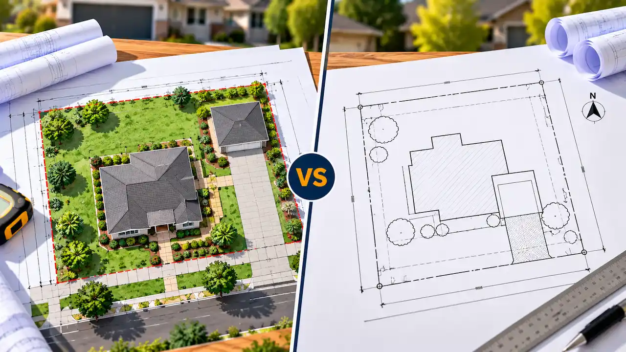
There is no single nationwide definition that every U.S. permitting authority uses consistently. In everyday residential permitting, plot plan often describes a relatively straightforward property drawing used to show where a proposed improvement will be located. Site plan is a broader term and can describe anything from a basic residential permit drawing to a detailed commercial or civil plan. That does not mean every document labeled “plot plan” is simple or every “site plan” is complex. Local terminology controls.
If a city says it requires a plot plan but its checklist asks for property lines, setbacks, structures, easements, utilities, parking, drainage, and other information, your drawing needs to include those items regardless of the name.
What Is a Plot Plan?
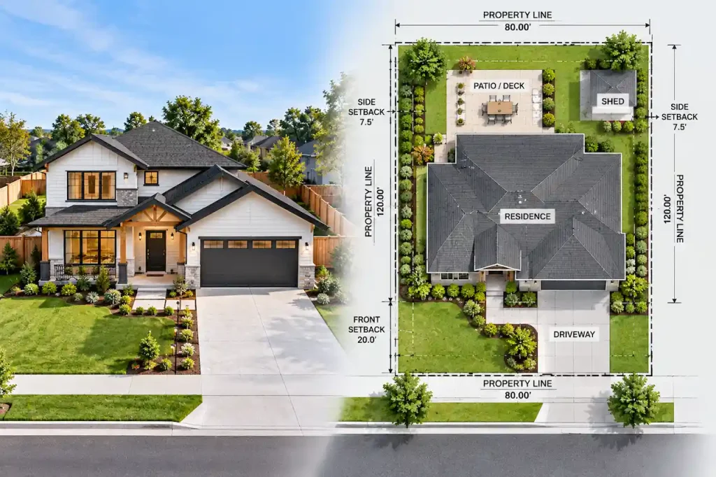
A plot plan generally shows a parcel from above and identifies the location of buildings and improvements in relation to the property boundaries. For a straightforward residential project, it may show the existing house, proposed structure, property lines, dimensions, and setback distances. Plot plans are commonly associated with projects such as fences, sheds, decks, pools, patios, garages, additions, and other residential improvements.
The main purpose is usually to answer a location question:
Where will the proposed work be placed on the lot?
If the permit reviewer can clearly determine the project’s location and verify the applicable zoning or site requirements, a relatively simple drawing may be enough for some permits.
What Is a Site Plan?
A site plan also shows the property from above, but the term can cover a much wider range of drawings. A residential site plan may look very similar to what another jurisdiction calls a plot plan. For larger or more complicated projects, however, a site plan may include considerably more information about access, parking, utilities, grading, drainage, landscaping, fire access, existing conditions, proposed improvements, and other site-development issues. This is particularly common for commercial development, new construction, substantial additions, land-development applications, and projects involving significant changes to the site. So the practical difference is often level of detail and project complexity, not simply the drawing title.
What Does the Permit Office Actually Need?
Start with the permit office’s checklist rather than the terminology. If the instructions say “submit a plot plan,” look immediately for the list of required information underneath that instruction. For a typical residential project, the permit office may want to identify the property and verify where the proposed work sits in relation to the lot.
Depending on the project, that can mean showing:
- Property boundaries and lot dimensions
- Existing house and relevant structures
- Proposed construction or improvement
- Dimensions of the proposed work
- Front, rear, and side setbacks
- Streets, alleys, or rights-of-way
- Driveways and access where relevant
- Known easements
- North arrow and drawing scale
- Address or parcel identification
Additional information may be required for specific projects. For example, a pool application may need information related to equipment or barriers. A garage may need driveway access and building separation. An addition may affect lot coverage. A commercial project can involve parking, accessibility, drainage, fire access, landscaping, and other requirements. The permit checklist determines the scope.
A Simple Way to Decide What You Need
Think about the permit request in three levels.
Level 1: Basic Property Placement
The permit office primarily needs to see where a relatively simple improvement will sit on the property. This may apply to some fences, sheds, decks, patios, or similar projects. A basic plot or site plan may be sufficient if the jurisdiction accepts that level of drawing. How to Get a Site Plan of My Property
Level 2: Detailed Residential Site Review
The project affects several zoning or site conditions. A garage, addition, ADU, pool, driveway expansion, or larger accessory structure may require more information about setbacks, lot coverage, easements, access, utilities, or existing improvements. The drawing is still a residential site plan, but it needs enough detail for those issues to be reviewed.
Level 3: Complex Site Development
The project involves commercial development, substantial grading, drainage, new infrastructure, major parking changes, subdivision, or other complex conditions. At this point, a simple homeowner-style plot plan is unlikely to represent the entire submission package. Detailed site, civil, architectural, structural, or engineering drawings may be required depending on the project.
Does a Plot Plan Need to Be to Scale?
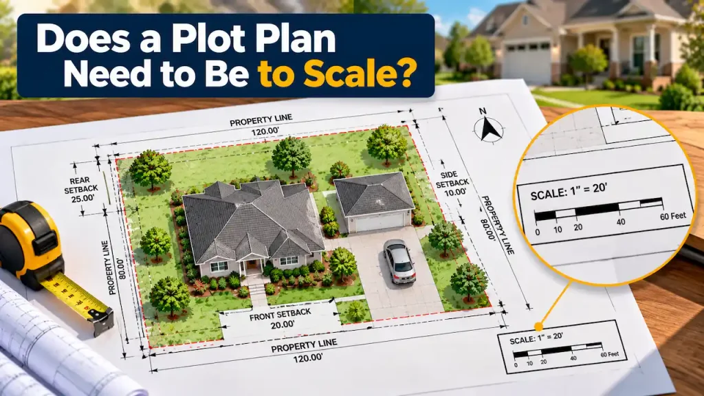
Permit drawings commonly need to communicate dimensions and relationships clearly, and many jurisdictions specify a drawing scale. A scaled drawing allows reviewers to understand how structures and improvements relate to the property. Do not assume that an aerial screenshot with a rectangle drawn over it will meet the requirement simply because the proposed project is visible. If the jurisdiction specifies a scale, sheet size, orientation, dimensioning standard, or other drawing requirement, follow those instructions. The plan should also clearly distinguish existing conditions from proposed work. That small detail can make a substantial difference during plan review.
Is a Plot Plan the Same as a Survey?
No, This distinction is important because permit terminology can create the impression that all property drawings are interchangeable. A boundary survey is prepared to establish or document property boundaries using professional surveying methods. A permit plot or site plan is generally prepared to communicate the location of existing and proposed improvements for review.
A site plan may use information from an existing survey, recorded plat, deed, parcel record, GIS data, or other available sources, depending on the project’s needs. But preparing a site plan from those records does not turn it into a boundary survey. If the city specifically asks for a current boundary survey, certified survey, or document prepared by a licensed surveyor, a standard drafted site plan should not be presented as a substitute.
Can You Submit an Existing Survey Instead?
Sometimes an existing survey is an excellent starting point, but whether it can be submitted by itself depends on what the permit office needs. Suppose you have an older survey showing the house and property boundaries, but you are applying for a new detached garage. The survey may accurately document the existing property, yet it does not show the proposed garage. The permit office needs to review the proposed condition, not just what exists today.
In some situations, the existing survey can be used as source information for preparing an updated permit site plan that shows the proposed work and relevant dimensions. In other situations, the jurisdiction may require a new or updated professional survey.
Can You Use GIS or County Parcel Records?
GIS maps and county parcel records can provide useful information about a property, but they should be used carefully. They may help identify parcel configuration, parcel numbers, nearby streets, general boundary locations, or other public-record information. However, GIS boundary lines are not automatically equivalent to surveyed property boundaries. This matters when a project is close to a property line or when precise boundary information is necessary to demonstrate compliance.
If your building department requires a survey, GIS data does not become a survey simply because it comes from a government website. For projects where the jurisdiction permits a non-certified site plan based on available records, parcel information may still be useful as one of several source documents.
When Is a More Detailed Site Plan Usually Needed?
Project complexity is a better indicator than terminology. Consider a small fence replacement versus a new commercial building. The fence permit may primarily involve location, height, property lines, and visibility or zoning restrictions. The commercial project can involve building placement, parking counts, accessible routes, loading, fire department access, utilities, grading, drainage, landscaping, stormwater management, and numerous other site conditions.
Both applications might contain a document called a “site plan,” but they are clearly not the same type of drawing. The same principle applies within residential permitting. An ADU or major addition can require substantially more site information than a small shed.
When Might a Professional Stamp Be Required?
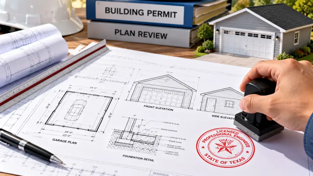
Calling a drawing a site plan does not determine whether it needs to be stamped. Professional requirements depend on the type of work, applicable law, project scope, and local permitting rules. Some residential projects may allow a non-certified site plan. Other projects may require documents prepared, reviewed, signed, or sealed by a licensed surveyor, professional engineer, architect, or another qualified professional. Structural, drainage, grading, or other technical work can also introduce separate professional requirements. If the permit checklist specifies a professional credential or seal, a basic drafting service is not a substitute for that requirement.
What If the Permit Checklist Just Says “Site Plan Required”?
This is where applicants often become confused. Do not stop at the phrase itself. Look for a site-plan checklist, permit application guide, zoning handout, sample drawing, or submission requirements published by the jurisdiction.
The questions to answer are:
What information must appear on the drawing?
Does the city require a survey or professional certification?
What scale or sheet format is required?
Does the project trigger additional zoning, engineering, drainage, or access review?
If the published instructions are unclear, ask the permit office what it expects for your specific permit type. It is much easier to clarify the requirement before preparing the plan than to discover the missing information after submission.
Common Reasons a Plot or Site Plan Gets a Correction
A drawing can have the correct title and still be incomplete. For example, a plan labeled “Site Plan” may be returned because it does not show property-line dimensions or setbacks. Another may show the proposed structure but omit the existing house, driveway, easement, or street. Permit reviewers can also have difficulty when existing and proposed improvements use identical linework with no clear labels. Other corrections arise because applicants submit an old property document without adding the proposed construction.
The lesson is simple:
Permit approval depends on the information communicated by the drawing—not the words “plot plan” or “site plan” printed at the top.
Plot Plan vs Site Plan for Common Residential Projects
The type of project can help indicate the amount of information likely to be needed. A fence permit may primarily need the fence location, property boundaries, and relevant setbacks. A shed plan may need the structure footprint, dimensions, property-line setbacks, and relationship to existing buildings. A garage site plan can involve setbacks, driveway access, easements, utilities, building separation, and lot coverage. A pool site plan can introduce additional placement, equipment, access, barrier, drainage, or impervious-area considerations. An addition or ADU Site Plan may require a more complete site plan because the work changes the building footprint and can affect zoning calculations and other property requirements.
These are general examples. The local permit authority determines what must actually be submitted.
Plot Plan vs Site Plan vs Full Permit Drawing Set
There is another distinction homeowners should understand. A site or plot plan usually represents only one part of the permit documentation. Suppose you are building a detached garage.
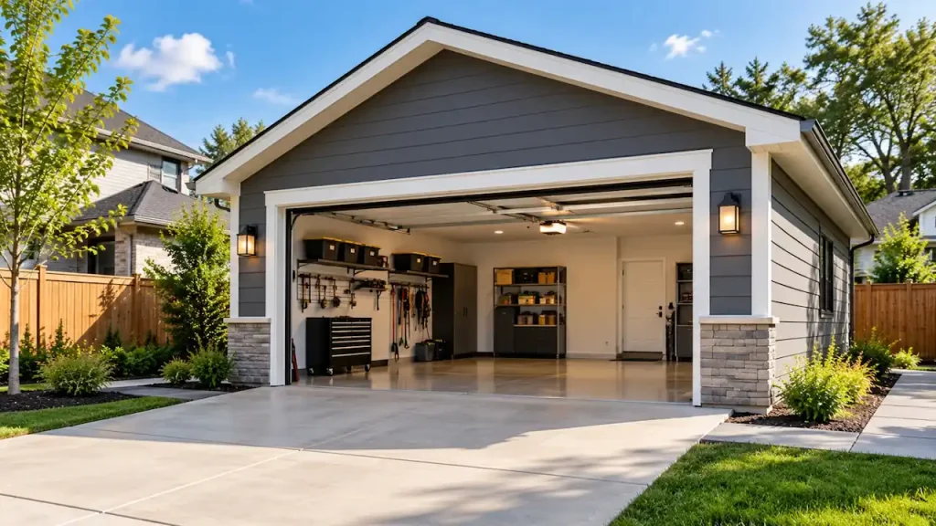
The site plan shows where the garage will be placed. Floor plans show the building layout. Elevations show the exterior appearance and heights. Foundation and structural drawings explain how the garage will be built.
Depending on the project, the complete permit package may contain several of these documents. Therefore, when a permit office asks for a site plan, that does not necessarily mean a site plan is the only drawing required for the permit.
Before Ordering a Plot Plan or Site Plan
First identify the exact project you are permitting. Then obtain the permit checklist from the city, county, or other authority reviewing the application. Gather whatever property information you already have, such as an existing survey, recorded plat, deed information, parcel records, previous plans, or approved drawings. You should also know the approximate size and intended location of the proposed project.
If you have already submitted and received corrections, provide the complete correction notice. It often identifies exactly what information the reviewer wants added or changed.
These documents make it much easier to determine whether you need a straightforward permit site plan or something more specialized.
What Information Is Needed to Prepare a Plot Plan or Site Plan?
The information needed to prepare a permit plan depends on the property, proposed work, and requirements of the reviewing authority. Providing complete information at the beginning can help determine the correct scope of the drawing and reduce unnecessary revisions.
Useful documents and project details may include:
- Property address and parcel information
- The permit application or site-plan checklist
- An existing property survey or recorded plat, if available
- Previous approved plans or property drawings
- Dimensions of the proposed structure or improvement
- Approximate location of the proposed work
- Known easements, driveways, utilities, or other relevant site features
- Any correction notice received from the permit office
If an existing survey is available, it can often provide useful source information about the property. However, additional information may still be needed to show the proposed project and satisfy the current permit requirements.
For example, an older survey may accurately show the house and property boundaries but not a new garage, pool, addition, or accessory structure. The permit drawing needs to communicate the proposed condition as well as the existing property.
How Much Does a Plot Plan or Site Plan Cost?
There is no single price for every plot plan or site plan because the required work can vary considerably from one project to another. A straightforward residential plan prepared from clear existing property information may require less work than a plan involving a large parcel, multiple structures, unusual site conditions, extensive permit requirements, or corrections from a previous submission.
Factors that can affect the cost include:
- Type and size of the proposed project
- Complexity of the property
- Amount and quality of existing property information
- Level of detail required by the permit office
- Whether revisions or correction responses are needed
- Additional requirements involving grading, drainage, utilities, or other site conditions
- Whether a licensed surveyor, engineer, architect, or other professional is required
Before ordering, provide the permit checklist and any available property documents whenever possible. This makes it easier to determine the appropriate scope before drafting begins. If the jurisdiction requires a boundary survey, engineered design, professionally sealed document, or another specialized service, those requirements should be identified separately from the cost of a basic permit site plan.
How Long Does It Take to Get a Plot Plan or Site Plan?
Turnaround time also depends on the project and the information available. A straightforward residential plan can generally be prepared more efficiently when the property records, existing survey, proposed dimensions, and permit requirements are already available. More complicated projects may require additional research, clarification, or documentation before the plan can be completed.
Turnaround can be affected by:
- Project complexity
- Availability of an existing survey or property records
- Accuracy and completeness of the information provided
- Permit-office drawing requirements
- Requested revisions
- Correction comments from a previous submission
- Additional professional or technical requirements
Providing the permit checklist, existing property documents, proposed project dimensions, and any correction notice at the beginning can help avoid delays caused by missing information.
It is also important to distinguish drawing preparation time from permit approval time. Preparing the site plan is only one part of the permitting process. The local authority controls its own review schedule, correction process, and final approval timeline.
So, Should You Order a Plot Plan or a Site Plan?
Do not choose based only on the name. Choose a drawing that satisfies the actual permit requirements for your project. For many straightforward residential permits, “plot plan” and “site plan” may describe essentially the same type of property-location drawing.
As projects become more complex, the term site plan can represent a much more detailed document. And when the permit office specifically requires a survey, engineered plan, stamped document, grading plan, drainage plan, or another professional deliverable, a basic plot plan should not be used as a substitute.
Site Plans Online prepares permit site plans and related drawing packages based on the project scope, available property information, and submission requirements provided for the job.
Providing the permit checklist, project address, proposed work, existing survey or property records, and any correction comments helps establish the right scope before drafting begins.
Frequently Asked Questions
Is a plot plan the same as a site plan for a permit?
Sometimes. Many permit offices use the terms interchangeably for residential projects, while others use “site plan” for a more detailed drawing. Follow the jurisdiction’s required content rather than relying only on the document name.
What does a plot plan need to show for a building permit?
Typical information can include property boundaries, existing structures, proposed construction, dimensions, setbacks, streets, access, known easements, north arrow, and scale. The exact requirements depend on the project and jurisdiction.
Can I use my property survey as a plot plan?
An existing survey can be useful, but it may not show the proposed construction or all information required for the permit. Some jurisdictions may accept an appropriately updated drawing, while others may require a current survey or other specific document.
Can I draw my own plot plan?
Some jurisdictions allow property owners to prepare simple plans for certain projects if all required information is accurate and clearly shown. Other projects or jurisdictions require professionally prepared or certified documents. Check the applicable permit requirements first.
Is a county parcel map enough for a building permit?
Not automatically. Parcel and GIS maps can provide useful property information, but approximate GIS boundaries are not the same as professionally surveyed boundaries. Acceptance depends on the permit office and project.
Does a site plan need an engineer’s stamp?
Not every site plan requires an engineer’s stamp. Professional requirements depend on the jurisdiction and scope of work. Structural, civil, grading, drainage, or other technical components may have separate engineering requirements.
Do I need both a site plan and construction drawings?
Many building projects do. The site plan establishes where the project is located on the property, while construction drawings explain what is being built and how. The permit checklist should identify the required drawing set.
What should I do if the city only says “plot plan required”?
Find the city’s plot-plan checklist, permit guide, or sample drawing and determine exactly what must appear on the plan. If the requirements remain unclear, confirm them with the permitting authority before preparing the submission.
Get Your Permit Drawing Scope Reviewed
Send us the property address and project details. We’ll help identify the likely drawing scope and next step.

Engineer Wasim
Civil/Structural Engineer and founder behind Site Plans Online USA. His permit-drafting experience dates back to 2015, supporting residential, commercial, structural and site-development projects.
Learn More About Site Plans LLC →